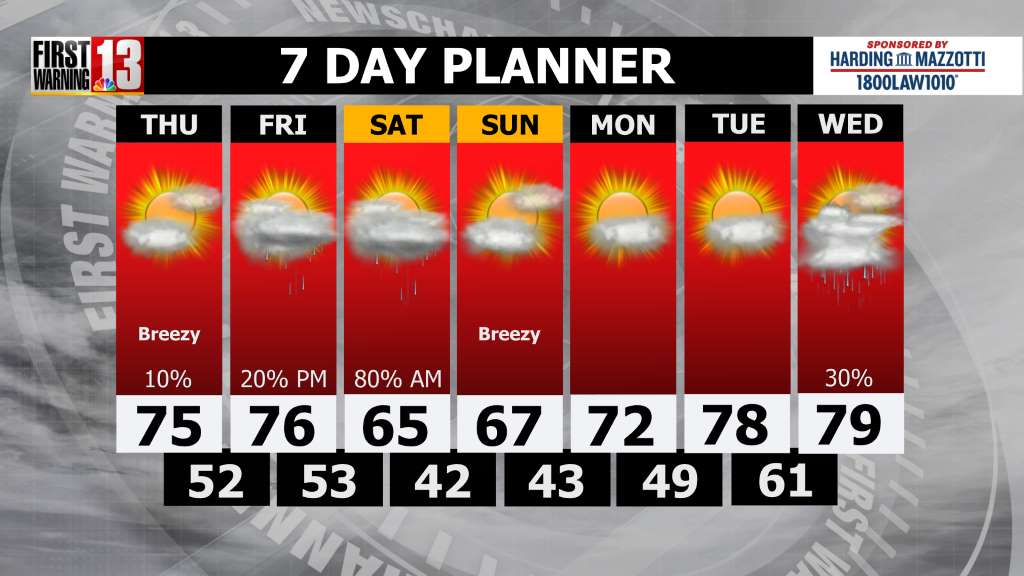
Rain will become steady and heavy at times as we go throughout the day today. Highs will be in the 40s and 50s. With mild temperatures, melting snow and total rainfall between 1-3 inches, some localized poor drainage flooding is possible Wednesday evening into Thursday morning. The heaviest rain will fall during the evening commute. Colder air will flow in behind this system which will turn rain to snow across higher elevations this evening. Valleys could see a light coat of snow overnight with a couple of inches possible in the hills and mountains. Overnight lows will be in the low 30s.
It will be breezy and much colder on Thursday with scattered lake effect snow showers and wind gusts as high as 30 mph. Highs will be in the 30s. Friday will stay dry but cold with mostly sunny skies and highs near 30.
Saturday will be dry with a mix of sun and clouds with highs in the low 30s. Sunday turn mostly cloudy with our next opportunity for scattered showers. Highs will be in the upper 30s.
Have a great day!